By Michael Brennan and Julius Saporito
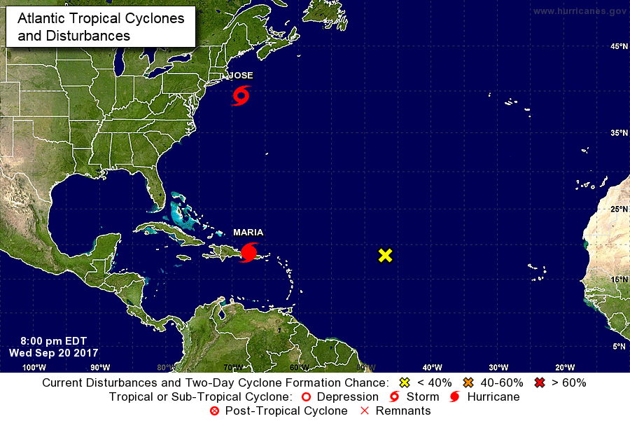
A map of Hurricane Maria hitting Puerto Rico and of Tropical Storm Jose approaching the northeastern United States, via NOAA.
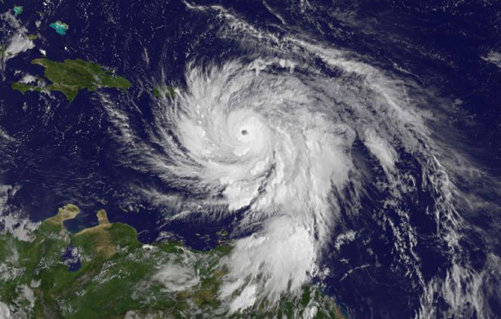
Image of Hurricane Maria via NASA on September 19 at 11 a.m.
MARIA
-
Nine people have been reported dead so far from the storm, with two from the French province Guadeloupe and seven from Dominica.
-
Hurricane Maria has hit Puerto Rico as a category four hurricane and has now downgraded to a category two storm, according to the NHC, as updated Sept. 20, at 11:45 a.m. EST.
-
Its path is projected north after hitting Puerto Rico according to the NHC, but the potential impact to the United States is too soon to know.
-
The entire territory of Puerto Rico is without power according to Abner Gómez, head of the Puerto Rican disaster management agency.
-
Puerto Rico’s governor Ricardo Rossello is asking President Trump to declare the territory as a disaster zone according to CBS News. Trump tweeted to Rossello on September 20 that he hopes the people of Puerto Rico are safe.
- Even government officials are holding shelters; the Prime Minister of St. Kitts & Nevis will be holding as many people as he can for shelter from the storm.
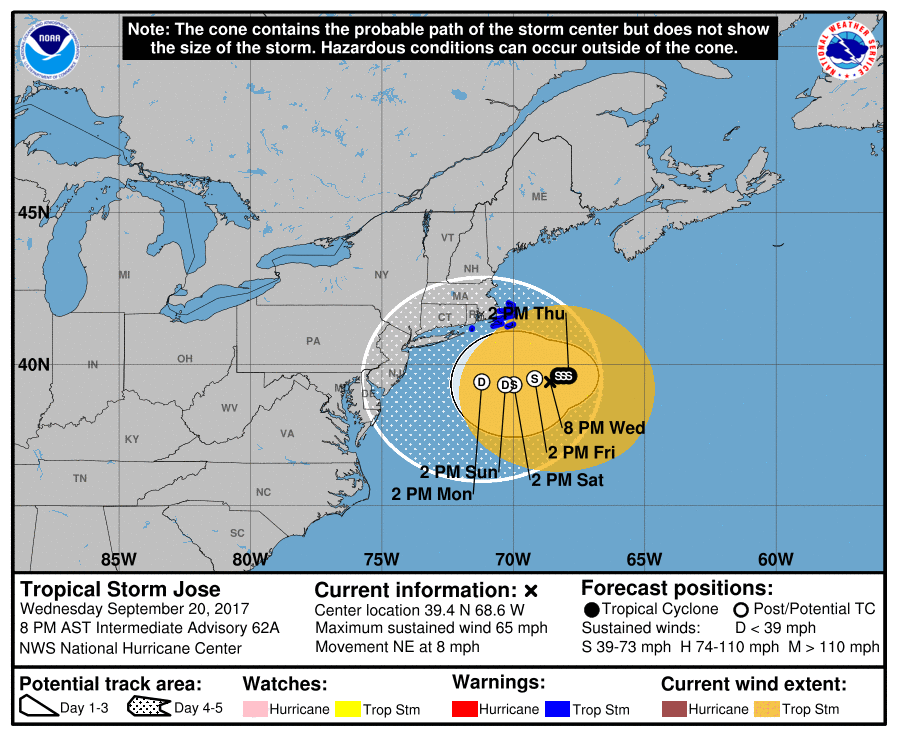
A projected path of Hurricane Jose, expected to hit Massachusetts as a tropical storm, from the National Hurricane Center.
JOSE
-
On Sept. 18, FEMA officially released a statement telling people in the paths of Jose and Maria to prepare for the storm now.
-
Jose was officially downgraded to a tropical storm on Sept. 19.
-
While the projections do appear that Jose will hit Connecticut, the National Hurricane Center has issued tropical storm warnings for Massachusetts-based areas such as Block Island and Martha’s Vineyard.
-
Tropical storm Jose is the less dangerous storm of the two, but people should still be cautious of it for the next few days.
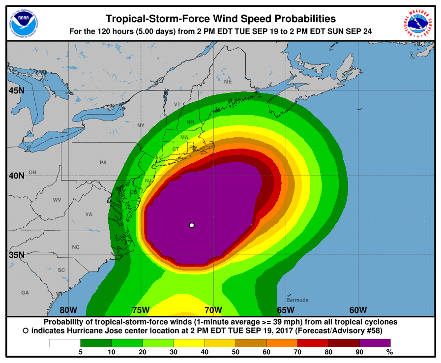
Tropical Storm wind projections, showing up to 30MPH winds expected to hit New Haven county over the next few days, according to the National Hurricane Center.
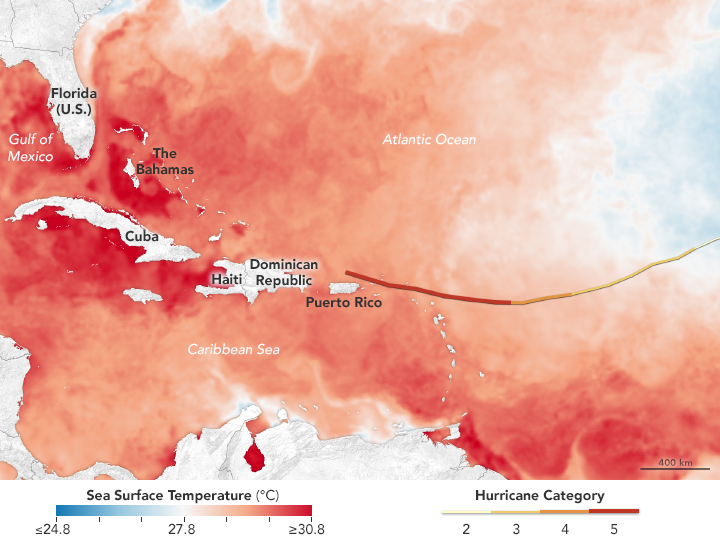
Photo by: NASA
IRMA
-
More than 40,000 federal personnel are working in support of preparedness in response to Hurricane Irma, according to FEMA.
-
Fema also states, “As of September 14, 2017, FEMA transferred approximately 6.6 million meals and 4.7 million liters of water to states in the Southeast, at the states’ requests. In addition, nearly 578,000 meals, 383,000 liters of water, 13,600 sheeting covers, 150 rolls of blue tarps, and 30 generators were transferred to St. Thomas and St. John.”
-
A total count of deaths have been labeled across several areas due to the storm.
Deaths-38 ( Caribbean) according to Wall Street Journal
Deaths -10 (Cuba) according to Wall Street Journal
-
According to MiamiHerald, a total of 18 counties in the South Florida area have suffered deaths from damages from storm (drowning), carbon monoxide, and cardiovascular disease.
-
In addition, it is a category four wind.
-
Fresh meals and water have been provided to the residents in the areas of Alabama, Florida, Georgia, North Carolina and South Carolina to help those in need of care and protection.
-
According to MiamiHerald, there have been 42 deaths partially due to carbon monoxide (South Florida- Hollywood, FL).
-
FPL Maps has been continuously updating power outages and recoveries across the state.
HARVEY
-
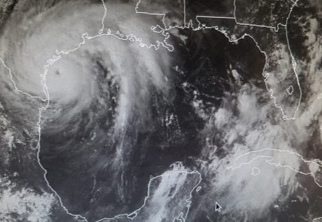
Houston, Texas suffers a huge tragedy in 82 deaths according to CBC news. Updated on Sept. 14 at 4:13 p.m. EST.
-
In addition, nearly 140,000 homes were wrecked in the storm and many families were left homeless or in need of repairs.
-
According to FPL Maps, a total of 35 counties around the area have completely lost power due to the storm.
-
Because so many houses were affected by the hurricane and need to be restored, the large cost to repair those damages might be the potential problem for the country.
- FPL Maps has been continuously updating power outages and recoveries across the state.
-
CBC news says, about 5,250 people are still living in shelters and working with the rest of the community to build their homes back to normal.
-
Hurricane Harvey is currently the biggest cost in U.S. disaster history, at an estimated price of $180 billion according to CBC news.